On Land Management and “Wilderness”
Many species in our savanna and woodland ecosystem are dependent on disturbance (e.g. fire, digging) for survival and reproduction.

Camas lily
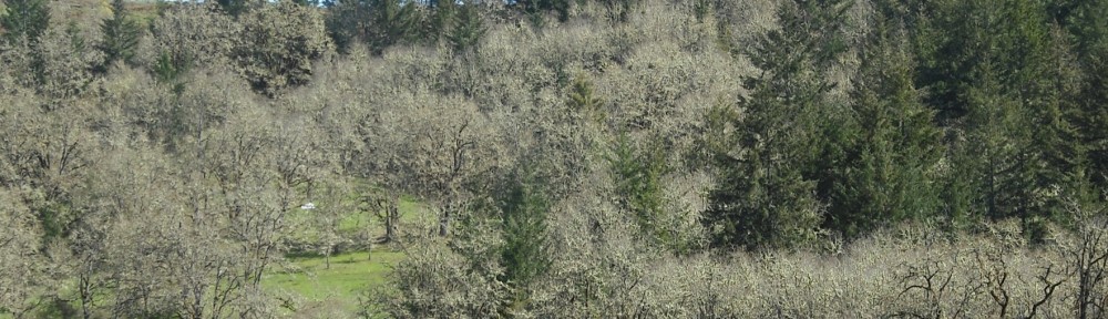
Every spring, thousands of tiny lily seedlings come up as thick as grass. In the past they would have been tended by Indian harvesters, digging and replanting as appropriate. Our camas lilies are shaded by a stand of oaks that is too thick. Traditionally burning would have kept the small trees, brush, and grass thinned, and people would have dug and moved the bulbs of lilies like camas and Dichelostemma sp. (Brodiaea sp.), reducing competition so the bulbs could grow larger.

OOkow (D. congesta)
These days, there is a lot of nonnative grass overtopping the native grass and plants, and burning would be one way to improve the condition of our savanna. This is problematic when you have neighbors, though, and very expensive to contain in one small area.
To get a perspective on just how prevalent Indian land management was, it is instructive to read M. Kat Anderson’s eye-opening Tending the Wild, Native American Knowledge and the Management of California’s Natural Resources (University of Ca Press, paperback ed 2006). The title of my post is taken from the introduction. Thanks to Dean, our mentor at the Yamhill Conservation District for telling me about this resource.
Here are some excerpts from Tending the Wild that challenged my notions of America before Europeans:
“John Muir, celebrated environmentalist and founder of the Sierra Club, was an early proponent of the view that the California landscape was a pristine wilderness before the arrival of Europeans. Staring in awe at the lengthy vistas of his beloved Yosemite Valley, or the extensive beds of golden and purple flowers in the Central Valley, Muir was eyeing what were really the fertile seed, bulb, and greens gathering grounds of the Miwok and Yokuts Indians, kept open and productive by centuries of carefully planned indigenous burning, harvesting, and seed scattering.”
“California Indians did not distinguish between managed land and wild land as we do today… Interestingly, contemporary Indians often use the word wilderness as a negative label for land that has not been taken care of by humans for a long time…’The white man sure ruined this country,’ said James Rust, a Southern Sierra Miwok elder. ‘It’s turned back to wilderness’ (pers.comm. 1989). California Indians believe that when humans are gone from an area long enough, they lose the practical knowledge about correct interaction, and the plants and animals retreat spiritually from the earth or hide from humans. When intimate interaction ceases, the continuity of knowledge, passed down through generations, is broken, and the land becomes ‘wilderness’.”
*****
“The first European explorers, American trappers, and Spanish missionaries entering California painted an image of the state as a wild Eden providing plentiful nourishment to its native inhabitants without sweat or toil. But in actuality, the productive and diverse landscapes of California were in part the outcome of sophisticated and complex harvesting and management practices…
Through coppicing, pruning, harrowing, sowing, weeding, burning, digging, thinning, and selective harvesting, they encouraged desired characteristics of individual plants, increased populations of useful plants, and altered the structures and compositions of plant communities.”
An often-cited passage from the journals of the Lewis and Clark expedition concerns a field of Camas lilies they thought resembled the blue water of a lake from a distance. The profound effects of Indian management of the land is expressed in the observation above that these practices altered the structure and composition of plant communities (and animal communities as well) – these attributes are what ecologists measure; the species composition defines an ecosystem at a basic level. Healthy, diverse systems provide the ecosystem services we all depend on. Therefore the fabric of the ecosystem (structure, composition) directly affects function.
For example, Anderson notes that all this management had the effect of increasing biodiversity and abundance. The absence of management has impoverished biological communities.
“Edible butterflies and moths, which were harvested in the larval and pupal stages, included the whitelined sphinx moth (Hyles lineata)…, and the pandora moth (Colorado pandora)…According to Western Mono elders, the pandora moth…used to be common on the west side of the Sierra Madre but now it is rare…Many Indians recalled that the tortoise-shell butterfly was common in chaparral (Ceanothus cuneatus) areas…and would come every year. It is now seen once every decade or so, and in some areas I has not been sighted for forty years.”
Indian familiarity with the biological world was deep and complex:
“The genus Arctostaphylos [manzanita] has a reputation among taxonomists as being difficult to identify at the species level. Not only do manzanita species hybridize readily in areas where distinct species overlap, but there are more than fifty recognized species in the genus in California. Yet this did not prevent the Miwok from encoding the differences in separate names for each type that occurred in their territory. The Karuk in extreme northwestern California identified at least four type of manzanitas in their territory.”
Anderson documents that this level of detail extended to location, soil and microclimate, and to timing of harvest based on when a plant was most suitable for a particular purpose. She cites others who have found this to be true:
“…[anthropologist A.L.] Kroeber’s 1939 field notes…record that the Yurok of northwestern California practiced burning at a frequency that was appropriate for each cultural purpose: burning of hazelnut for basketry occurred every two years; burning under the tan oaks to keep the brush down took place every three years; burning for elk feed occurred every fourth or fifth year; burning in the redwoods for brush and downed fuel control occurred every three to five years.”
Although Anderson’s book is based on her PhD research in California, much of the information on plants and management practices also applies to the Willamette Valley. The savanna and woodland landscape was maintained through the inland valleys of Oregon and southwestern Washington, the Puget Basin, to the tip of Vancouver Island (see range map of Oregon white oak in the sidebar information on the “about oaks” page of this site). Here is some information about Willamette Valley people:
About the Kalapuya in the Willamette Valley
Kalapuya people say “We have always been here.” For many thousands of years before the onset of Euro-American settlement, the Kalapuya were the largest Indian group in what is now called western Oregon. It is estimated that Kalapuya people numbered 15,000 at the time of Euro-American contact. The traditional Kalapuya territory encompassed most of the Willamette Valley, from present day Oregon City in the north to Yoncalla, in the Upper Umpqua valley. There were 13 distinct groups of Kalapuya people, speaking three dialects of the Kalapuyan language.
Contrary to what is commonly believed, the Kalapuya were not nomadic. The people lived in permanent villages of wooden plank-framed houses which were located throughout the region. Temporary shelters of wood and brush were constructed at fishing and hunting sites. Dugout canoes were used to navigate rivers and streams, facilitating transportation and food gathering.
The Kalapuya were hunters of large and small game, subsisting on deer and elk, supplemented by a variety of fish. Time-tested plant gathering techniques provided a balanced diet for the people. The camas lily was a vital food – bulbs were roasted in stone-lined ovens and pressed into cakes for winter use. These camas-flour cakes also were used as trade items.
When the first explorers entered the Willamette Valley, they witnessed a yearly burning of sections of the valley floor by the Kalapuya. This was done to maintain grasslands, to concentrate game in certain areas, and also to roast seeds of the wild sunflower. These seeds were a food resource, and yielded oil for ceremonial use. Early settlers saw field burning as a dangerous practice and it was banned by the time the Kalapuya were removed to reservations in the mid-1800s. As a consequence, brush and weeds quickly encroached on farmland, and grasshopper infestations destroyed crops. [bloggers note: grasshoppers in the fields were eaten by the Kalapuya after being roasted in the fires they set]
Shortly after 1850 the United States government began a treaty process with the Kalapuya people. The unratified treaty of 1855 ultimately removed most of the Kalapuya to reservations at Grand Ronde and Siletz, opening up the Willamette Valley to occupation by settlers.
Diseases carried by Euro-Americans soon decimated the Kalapuya population. Many died of smallpox, malaria and scrofula, an illness related to tuberculosis. But the Kalapuya have not vanished. Today, an estimated 300 to 400 Kalapuya remain, many of whom uphold the age-old culture and tradition of the ancestors.
SOURCE: Nearby Nature website http://www.nearbynature.org/parks/talking-stones accessed June 16, 2010.